2013
SD6883 : The boundary ducks and dives at Top of Low Stools
taken 11 years ago, 4 km W of Deepdale, Cumbria, England
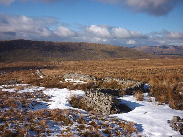
The boundary ducks and dives at Top of Low Stools
The ramshackle drystone wall was once the boundary between Westmorland and Yorkshire. Since 1974 it has been demoted to a parish boundary and also the national park boundary (this may soon include the land I am standing on - watch this space). For some unfathomable reason the wall builders put a kink in the wall here at the strangely-named 'top'. Perhaps there was a team building uphill and another building downhill and they didn't quite line up? Whatever the reason it once altered a county boundary.
 Map © Crown Copyright")
TIP: Click the map for more Large scale mapping
- Grid Square
- SD6883, 6 images (more nearby 🔍)
- Photographer
- Karl and Ali (more nearby)
- Date Taken
- Sunday, 24 February, 2013 (more nearby)
- Submitted
- Tuesday, 26 February, 2013
- Subject Location
-
OSGB36:
 SD 6874 8374 [10m precision]
WGS84: 54:14.9029N 2:28.8744W - Camera Location
-
OSGB36: SD 6875 8373
- View Direction
- North-northwest (about 337 degrees)