2013
SE4824 : St.Andrew's church
taken 11 years ago, near to Ferrybridge, Wakefield, England
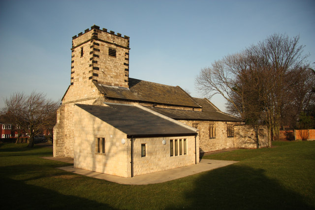
St.Andrew's church
Ferrybridge parish church with a long history and fascinating story. With 11th century origins, though largely 12th, 13th & 14th century, it originally stood on a site about 400m north. The site frequently flooded and was surrounded by Ferrybridge B Power Station in the 1950s, so the whole church was moved stone by stone and rebuilt 1952-53 on this site Link with some alterations.
 Map © Crown Copyright")
TIP: Click the map for more Large scale mapping
- Grid Square
- SE4824, 334 images (more nearby 🔍)
- Photographer
- Richard Croft (more nearby)
- Date Taken
- Thursday, 28 February, 2013 (more nearby)
- Submitted
- Monday, 4 March, 2013
- Subject Location
-
OSGB36:
 SE 4802 2414 [10m precision]
WGS84: 53:42.6888N 1:16.4364W - Camera Location
-
OSGB36: SE 4801 2413
- View Direction
- Northeast (about 45 degrees)