2013
NH5748 : End of Redcastle pier
taken 11 years ago, near to Redcastle, Highland, Scotland
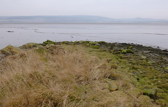
End of Redcastle pier
Looking south across the Beauly Firth in the mist.
The low tide reveals a large area of mudflats, with a few small streams flowing through.
The low tide reveals a large area of mudflats, with a few small streams flowing through.
 Map © Crown Copyright")
TIP: Click the map for more Large scale mapping
- Grid Square
- NH5748, 8 images (more nearby 🔍)
- Photographer
- Craig Wallace (more nearby)
- Date Taken
- Tuesday, 5 March, 2013 (more nearby)
- Submitted
- Tuesday, 5 March, 2013
- Subject Location
-
OSGB36:
 NH 5798 4895 [10m precision]
WGS84: 57:30.5040N 4:22.3287W - Camera Location
-
OSGB36: NH 57983 48971
- View Direction
- SOUTH (about 180 degrees)