2013
NG1756 : Ordnance Survey Benchmark at Dunvegan Head
taken 11 years ago, 3 km from Galtrigill, Isle of Skye, Scotland
This is 1 of 2 images, with title Ordnance Survey Benchmark at Dunvegan Head in this square
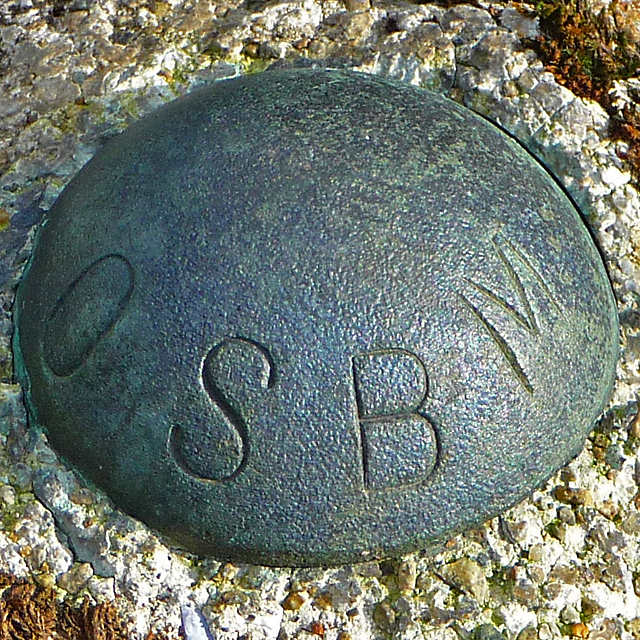
Ordnance Survey Benchmark at Dunvegan Head
A typical OS bolt attached to the bedrock with a little concrete.
A wider view can be seen in NG1756 : Ordnance Survey Benchmark at Dunvegan Head
A wider view can be seen in NG1756 : Ordnance Survey Benchmark at Dunvegan Head
 Map © Crown Copyright")
TIP: Click the map for more Large scale mapping
- Grid Square
- NG1756, 17 images (more nearby 🔍)
- Photographer
- John Allan (more nearby)
- Date Taken
- Wednesday, 6 March, 2013 (more nearby)
- Submitted
- Thursday, 7 March, 2013
- Subject Location
-
OSGB36:
 NG 1766 5680 [10m precision]
WGS84: 57:30.7825N 6:42.9928W - Camera Location
-
OSGB36: NG 1766 5680
- View Direction
- NORTH (about 0 degrees)