2013
SP4316 : Towards Queen Pool
taken 11 years ago, near to Woodstock, Oxfordshire, England
Towards Queen Pool
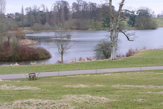
The footpath south of the Column of Victory heads further south than shown on the map, but this is where the stile is over the electric fence. Queen Pool, part of the dammed River Glyme that forms the central water feature of Blenheim Park, is behind. Shakespeare's Way goes along here, but even if he actually came this way he would not have recognised this view as it was created 100 years after he died.
Shakespeare's Way
Shakespeare's Way is a 146 mile long distance footpath from Shakespeare's birthplace in Stratford-upon-Avon to the Globe theatre in London. It follows as nearly as possible a route that Shakespeare may have taken between the two, but using footpaths, quiet lanes and towpaths, rather than his tracks, which are today's main roads.
 Map © Crown Copyright")
TIP: Click the map for more Large scale mapping
- Grid Square
- SP4316, 119 images (more nearby 🔍)
- Photographer
- Graham Horn (more nearby)
- Date Taken
- Sunday, 24 February, 2013 (more nearby)
- Submitted
- Sunday, 10 March, 2013
- Subject Location
-
OSGB36:
 SP 4383 1697 [10m precision]
WGS84: 51:50.9767N 1:21.9060W - Camera Location
-
OSGB36: SP 4379 1697
- View Direction
- EAST (about 90 degrees)