2013
NR3268 : Old Boundary Line on Maol Bun an Uillt, Islay
taken 11 years ago, 3 km from Craigens, Islay, Argyll And Bute, Scotland
This is 1 of 2 images, with title Old Boundary Line on Maol Bun an Uillt, Islay in this square
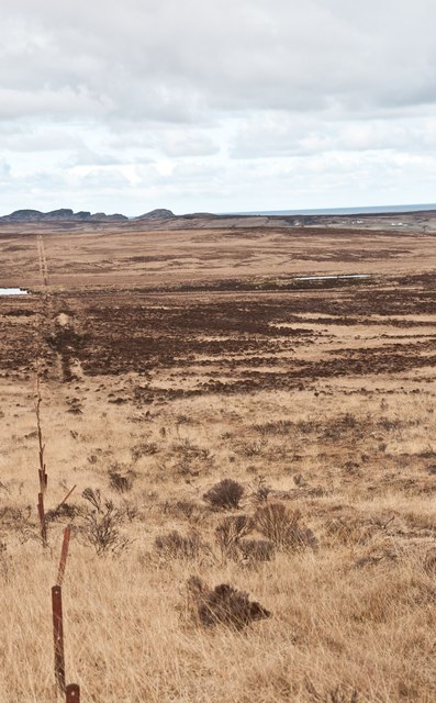
Old Boundary Line on Maol Bun an Uillt, Islay
Maol Bun an Uillt translates from Gaelic as 'Rounded Hill of the Mouth of the River'.
Looking towards Sanaigmore.
Looking towards Sanaigmore.
 Map © Crown Copyright")
TIP: Click the map for more Large scale mapping
- Grid Square
- NR3268, 10 images (more nearby 🔍)
- Photographer
- Becky Williamson (more nearby)
- Date Taken
- Tuesday, 12 March, 2013 (more nearby)
- Submitted
- Wednesday, 13 March, 2013
- Subject Location
-
OSGB36:
 NR 32114 68134 [1m precision]
WGS84: 55:49.9109N 6:16.7774W - Camera Location
-
OSGB36: NR 3212 6812
- View Direction
- West-northwest (about 292 degrees)