NS1967 : Skelmorlie Measured Mile
taken 11 years ago, near to Upper Skelmorlie, North Ayrshire, Scotland
Measured nautical miles were used to measure the speed of a new ship under sea trials before being handed over by the shipyard to the owner.
In simple terms, a nautical measured mile is a nautical mile which is marked by two pairs of posts. The ship, already at top speed and on the requisite bearing, sails from one pair of posts to the next. A stopwatch is started when the first two posts are aligned and then stopped when the next two posts are aligned. Each post has a V or inverted V shaped marker on it which forms an X with its partner post when they are exactly aligned.
To accurately measure performance ships must make several runs in both directions to compensate for variations in wind and tide.
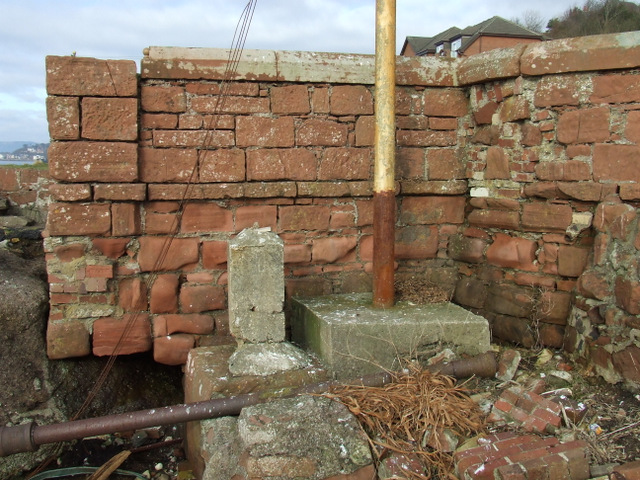
The Skelmorlie mile is a Category B Listed Structure. It was established 1866 by the Clyde shipbuilding firm of Robert Napier & Sons. It was surveyed by two different land surveyors, namely Kyle & Frew and Smith & Wharrie and was checked by admiralty staff.
It consists of two pairs of tall poles, each pair set one nautical mile from each other. The poles are set on concrete bases, with iron stays, and sight markers at the upper level.
The northern pair of posts can be found by the bus shelter at the foot of the Hydro Steps, near the turning point on Shore Road. One of these is on the shore and can be accessed by walking a couple of hundred metres south and entering the beach by the steps at the small pumping station.
The other northern post is mounted halfway up a cliff and has fallen into severe disrepair, the top half having snapped and fallen to the side.
The southern pair of posts are at the south end of Skelmorlie, immediately south of Skelmorlie Castle. One of these is on the rocky shore, near the A78 road, the other is in a field between the A78 and Meigle.
There are several other nautical measured miles around the British Isles, including at the nearby Isle of Arran:-
* Two consecutive miles on the Isle of Arran, between South Sannox and Corloch.
* Between Talland Bay and Hannafore, West Looe, Cornwall.
* There are four Admiralty Distance Poles at St Abb's Head
 Map © Crown Copyright")
- Grid Square
- NS1967, 213 images (more nearby 🔍)
- Photographer
- Thomas Nugent (more nearby)
- Date Taken
- Thursday, 28 February, 2013 (more nearby)
- Submitted
- Wednesday, 13 March, 2013
- Subject Location
-
OSGB36:
 NS 1919 6755 [10m precision]
WGS84: 55:52.0263N 4:53.4676W - Camera Location
-
OSGB36: NS 1919 6753
- View Direction
- NORTH (about 0 degrees)