2013
NZ0843 : Quickburn Grange
taken 11 years ago, 3 km from Satley, County Durham, England
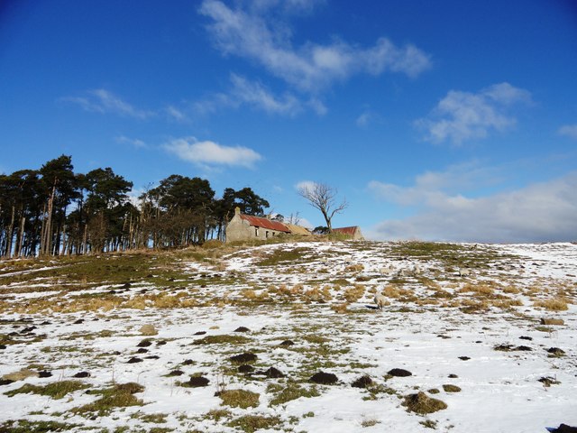
Quickburn Grange
Old ruined farmstead in the fields north of the road from the A68 to Salter's Gate. However building work was going on, which must mean someone is going to reoccupy the place, which makes a nice change.
 Map © Crown Copyright")
TIP: Click the map for more Large scale mapping
- Grid Square
- NZ0843, 17 images (more nearby 🔍)
- Photographer
- Robert Graham (more nearby)
- Date Taken
- Wednesday, 13 March, 2013 (more nearby)
- Submitted
- Sunday, 17 March, 2013
- Subject Location
-
OSGB36:
 NZ 0848 4309 [10m precision]
WGS84: 54:46.9587N 1:52.1804W - Camera Location
-
OSGB36: NZ 0857 4302
- View Direction
- Northwest (about 315 degrees)