SX9372 : Northeast end of Quay Road, Teignmouth
taken 12 years ago, near to Teignmouth, Devon, England
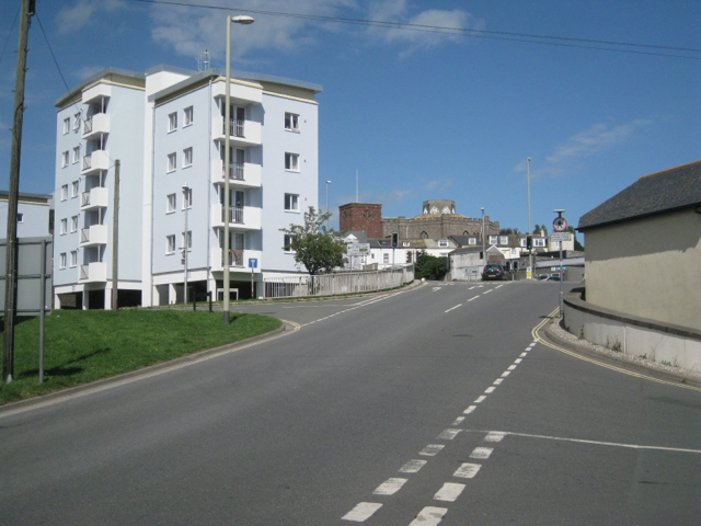
Teign Housing reports on their website: Link
In December 2012 we completed our £4million regeneration project of five blocks of flats that dominate the skyline in central Teignmouth. The project that started in November 2012 has dramatically improved the look of the area which is described as the 'gateway to Teignmouth'. The new design has turned these blocks from being out-of-date, into something much more striking that will benefit residents, local businesses and tourism.
Not only can we provide new, good quality homes, but we can also regenerate our existing housing stock to make areas more desirable and enhance communities. The improvements to the external walls and roofs of these blocks are not just for cosmetic purposes, but will also improve the energy efficiency of each building and will allow each household to save, on average, £180 a year on energy bills.
This regeneration project was part of the original promise agreement made when Teignbridge District Council transferred their stock to Teign Housing back in 2004.
 Map © Crown Copyright")
- Grid Square
- SX9372, 1927 images (more nearby 🔍)
- Photographer
- Robin Stott (more nearby)
- Date Taken
- Sunday, 19 August, 2012 (more nearby)
- Submitted
- Friday, 29 March, 2013
- Subject Location
-
OSGB36:
 SX 9385 7297 [10m precision]
WGS84: 50:32.8097N 3:29.9738W - Camera Location
-
OSGB36: SX 9383 7293
- View Direction
- North-northeast (about 22 degrees)