SJ7387 : Deer in Dunham Massey Deer Sanctuary
taken 11 years ago, near to Little Bollington, Cheshire East, England
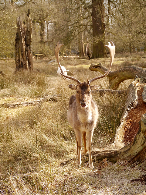
Today, the present herd numbers approximately 150. Four colours of fallow deer roam Dunham Massey: black, common, menil and white. The bucks grow new antlers each year, ready for the autumn rut.
Dunham Massey Hall and garden are immediately west of the village of Dunham Town, with the deer park, the only medieval park in Trafford to survive to the present day, lying to the south of the hall.
The present hall was initially built in 1616, but was later remodelled for George, Earl of Stamford and Warrington between 1732 and 1740; it was also altered towards the end of the eighteenth century and in the early twentieth century. During the First World War, the hall was used as a military hospital.
The hall and grounds were donated to the National Trust by the last Earl of Stamford, in 1976 They are open to the public and are amongst Britains leading visitor attractions. The hall itself, the stables, and the carriage house of Dunham Massey are all Grade I listed buildings.
The garden houses over 700 plant species, as well as 1,600 trees and shrubs, and it hosts the largest winter garden in Britain (LinkThe Guardian). The Winter Garden has many snowdrops, daffodils and bluebells
 Map © Crown Copyright")
- Grid Square
- SJ7387, 623 images (more nearby 🔍)
- Photographer
- David Dixon (more nearby)
- Date Taken
- Friday, 29 March, 2013 (more nearby)
- Submitted
- Sunday, 31 March, 2013
- Subject Location
-
OSGB36:
 SJ 738 870 [100m precision]
WGS84: 53:22.7571N 2:23.7189W - Camera Location
-
OSGB36: SJ 738 870
- View Direction
- South-southwest (about 202 degrees)