2013
SX9266 : Collapsing house, Babbacombe
taken 11 years ago, near to Babbacombe, Torbay, England
This is 1 of 6 images, with title Collapsing house, Babbacombe in this square
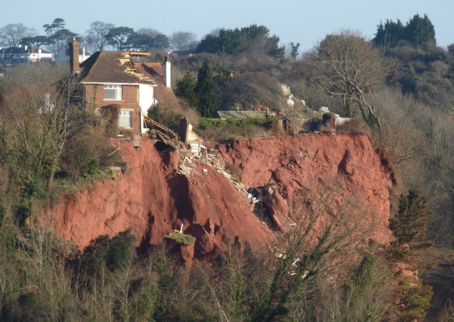
Collapsing house, Babbacombe
Taken from further east than SX9266 : Collapsing house, Babbacombe, and giving a slightly clearer view, distinguishing it more from the house behind. Note the isolated pinnacle with a square of grass and piece of fence, perhaps, in the foreground, and which seem unlikely to last long.
 Map © Crown Copyright")
TIP: Click the map for more Large scale mapping
- Grid Square
- SX9266, 243 images (more nearby 🔍)
- Photographer
- Derek Harper (more nearby)
- Date Taken
- Wednesday, 3 April, 2013 (more nearby)
- Submitted
- Friday, 5 April, 2013
- Subject Location
-
OSGB36:
 SX 9249 6611 [10m precision]
WGS84: 50:29.0946N 3:31.0064W - Camera Location
-
OSGB36: SX 9257 6560
- View Direction
- NORTH (about 0 degrees)