2013
SK5438 : The tram route
taken 11 years ago, near to Lenton, Nottingham, England
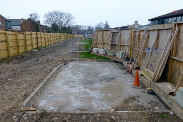
The tram route
Between Science Road on the university and University Boulevard. Various art department buildings form a line along the left. The site here used to house a lido. Link (Archive Link )
NET Phase 2, April 2013
A series of images showing what the state of progress is on the development of the new tram routes to Clifton and Chilwell.
For a month by month overview of the complete project, see this Link
 Map © Crown Copyright")
TIP: Click the map for more Large scale mapping
- Grid Square
- SK5438, 523 images (more nearby 🔍)
- Photographer
- David Lally (more nearby)
- Date Taken
- Thursday, 11 April, 2013 (more nearby)
- Submitted
- Friday, 12 April, 2013
- Subject Location
-
OSGB36:
 SK 546 382 [100m precision]
WGS84: 52:56.3429N 1:11.2699W - Camera Location
-
OSGB36: SK 546 383
- View Direction
- South-southeast (about 157 degrees)