2013
J5264 : The Loughshore, Mahee Island
taken 11 years ago, 4 km NE of Killinchy, Co Down, Northern Ireland
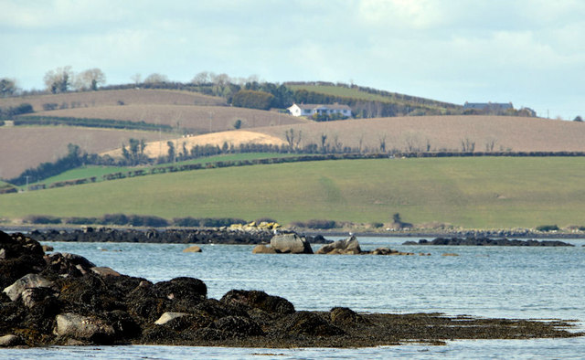
The Loughshore, Mahee Island
A scene fairly typical of the western side of Strangford Lough. The tip of the western end of Mahee Island (at Nendrum) is towards the bottom. The drumlins at Cadew Point J5163 : Cardew Point, Strangford Lough are in the background. The view is from the south western shore of Reagh Island about 3½ hours after high water Killyleagh.
Loading map... (JavaScript required)
- Grid Square
- J5264, 39 images (more nearby 🔍)
- Photographer
- Albert Bridge (more nearby)
- Date Taken
- Saturday, 20 April, 2013 (more nearby)
- Submitted
- Saturday, 20 April, 2013
- Subject Location
-
Irish:
 J 523 640 [100m precision]
WGS84: 54:30.0919N 5:38.9766W - Camera Location
-
Irish: J 523 640
- View Direction
- West-southwest (about 247 degrees)