2013
SK5363 : Mansfield Woodhouse Area NG19, Notts
taken 11 years ago, near to Mansfield Woodhouse, Nottinghamshire, England
This is 1 of 2 images, with title Mansfield Woodhouse Area NG19, Notts. in this square
Mansfield Woodhouse Area NG19, Notts.
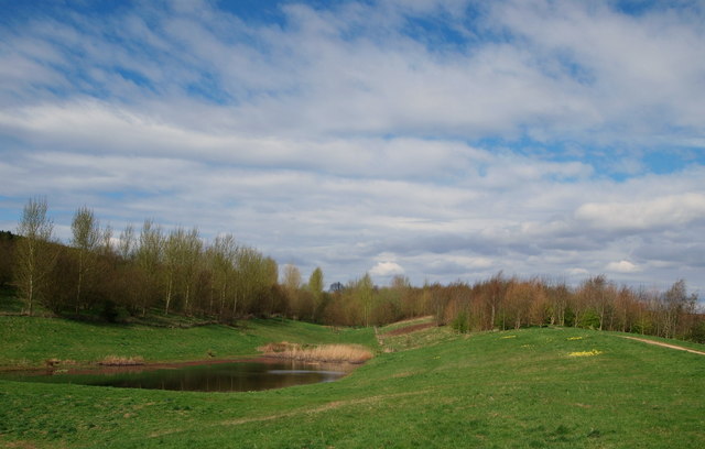
The smaller of two lakes in this part of the parkland forming part of the Oxclose Wood site. A vast area of land, that included the former Sherwood Colliery spoil tip(s) has been developed in an unstaffed country park, albeit not designated as such. The elevated footpath on the right connects the section of Oxclose Lane nearest to the village of Mansfield Woodhouse with the Northfield Lane side of park, i.e. in the past the tip(s) expanded upwards and outwards and a series of footpaths have now been constructed to encircle and surmount the landscaped tips.
 Map © Crown Copyright")
TIP: Click the map for more Large scale mapping
- Grid Square
- SK5363, 68 images (more nearby 🔍)
- Photographer
- David Hallam-Jones (more nearby)
- Date Taken
- Sunday, 28 April, 2013 (more nearby)
- Submitted
- Monday, 29 April, 2013
- Subject Location
-
OSGB36:
 SK 5308 6358 [10m precision]
WGS84: 53:10.0020N 1:12.4485W - Camera Location
-
OSGB36: SK 5309 6357
- View Direction
- West-northwest (about 292 degrees)