2013
TF9744 : View along Garborough Creek, Stiffkey
taken 11 years ago, near to Stiffkey, Norfolk, England
This is 1 of 2 images, with title View along Garborough Creek, Stiffkey in this square
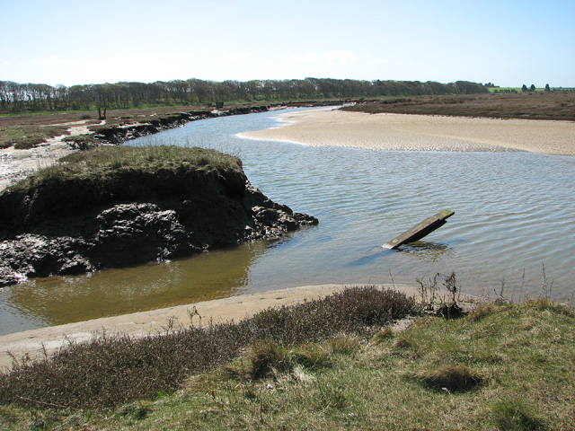
View along Garborough Creek, Stiffkey
This view was taken by the fourth bridge, looking towards the Norfolk Coast Path the course of which is denoted by the trees seen growing in the background. The area gets flooded regularly; a study of the tide table is strongly recommended before venturing out as the tide comes in very fast. The paths can be very muddy at the best of times.
 Map © Crown Copyright")
TIP: Click the map for more Large scale mapping
- Grid Square
- TF9744, 113 images (more nearby 🔍)
- Photographer
- Evelyn Simak (more nearby)
- Date Taken
- Wednesday, 1 May, 2013 (more nearby)
- Submitted
- Wednesday, 1 May, 2013
- Subject Location
-
OSGB36:
 TF 9740 4434 [10m precision]
WGS84: 52:57.6052N 0:56.2519E - Camera Location
-
OSGB36: TF 9741 4436
- View Direction
- Southwest (about 225 degrees)