2013
TQ2266 : Sherbrooke Way, The Hamptons
taken 11 years ago, near to Worcester Park, Sutton, England
Sherbrooke Way, The Hamptons
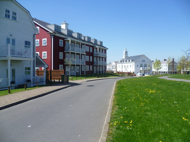
In the early 20th century, the Epsom Sewage Farm occupied a small site immediately south of Green Lane. By the 1960s what was now Worcester Park Sewage Works had expanded southwards to cover about half the area now occupied by The Hamptons and after that it further expanded to the east and west. After its closure in the 1990s it was redeveloped to create the Hamptons in a style reminiscent of New England. At the centre of The Hamptons lies a 'town hall', Maple Lodge, which was designed to be the hub for the whole community. This is seen here in the distance with its clock tower. Part of the development is a 31 acres new green space called Mayflower Park, which includes a grass amphitheatre for performances and an area of five wetlands forming a nature reserve.
 Map © Crown Copyright")
TIP: Click the map for more Large scale mapping
- Grid Square
- TQ2266, 44 images (more nearby 🔍)
- Photographer
- Marathon (more nearby)
- Date Taken
- Wednesday, 1 May, 2013 (more nearby)
- Submitted
- Wednesday, 1 May, 2013
- Subject Location
-
OSGB36:
 TQ 2282 6660 [10m precision]
WGS84: 51:23.1099N 0:14.1837W - Camera Location
-
OSGB36: TQ 2288 6654
- View Direction
- Northwest (about 315 degrees)