2013
SK3616 : Ashby-de-la-Zouch: the castle
taken 11 years ago, near to Ashby-de-la-Zouch, Leicestershire, England
Ashby-de-la-Zouch: the castle
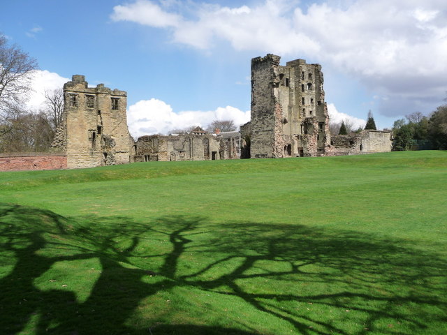
The site of a manor house in the 12th century, when owned by a line of Zouch descendants which give the town its name, the castle was greatly enlarged in the 1470s by William, Lord Hastings, on whom Edward IV bestowed it shortly before.
The largest part was the Hastings Tower, seen here to the right, some 90 feet in height and was originally not far off square.
A prolonged siege during 1645 led to the castle's surrender the following year. Part of the surrender terms included the demolition of the castle, although it was a few years before the major buildings were destroyed.
 Map © Crown Copyright")
TIP: Click the map for more Large scale mapping
- Grid Square
- SK3616, 223 images (more nearby 🔍)
- Photographer
- Chris Downer (more nearby)
- Date Taken
- Friday, 26 April, 2013 (more nearby)
- Submitted
- Saturday, 11 May, 2013
- Subject Location
-
OSGB36:
 SK 3612 1665 [10m precision]
WGS84: 52:44.7763N 1:27.9820W - Camera Location
-
OSGB36: SK 3608 1656
- View Direction
- North-northeast (about 22 degrees)