2013
ST7414 : Bridge over the Caundle Brook
taken 11 years ago, near to Lydlinch, Dorset, England
This is 1 of 2 images, with title Bridge over the Caundle Brook in this square
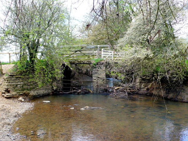
Bridge over the Caundle Brook
This is a farmers bridge to access fields on both sides of the brook. It is a short distance upstream from where the Caundle Brook meets the River Lydden. The water level was low from the recent lack of rain. It appears that this pool by the bridge is used extensively for watering livestock. See ST7414 : Bridge Over the Caundle Brook.
 Map © Crown Copyright")
TIP: Click the map for more Large scale mapping
- Grid Square
- ST7414, 10 images (more nearby 🔍)
- Photographer
- Nigel Mykura (more nearby)
- Date Taken
- Friday, 3 May, 2013 (more nearby)
- Submitted
- Wednesday, 15 May, 2013
- Subject Location
-
OSGB36:
 ST 7416 1414 [10m precision]
WGS84: 50:55.5678N 2:22.1417W - Camera Location
-
OSGB36: ST 7420 1413
- View Direction
- West-northwest (about 292 degrees)