2007
SN4300 : Old Pembrey Harbour
taken 17 years ago, near to Burry Port, Carmarthenshire/Sir Gaerfyrddin, Wales
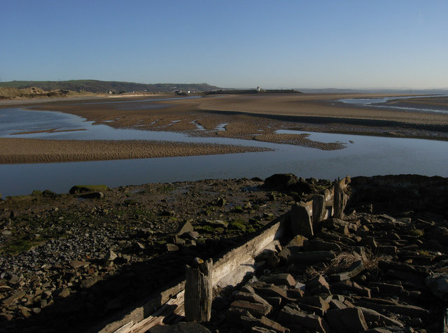
Old Pembrey Harbour
Now silted over, this was once a thriving little harbour that served to export the coal mined from nearby Pembrey Mountain. A new Pembrey harbour was built but soon renamed Burryport Harbour. It can be seen in the distance in this photo.
 Map © Crown Copyright")
TIP: Click the map for more Large scale mapping
- Grid Square
- SN4300, 74 images (more nearby 🔍)
- Photographer
- Dave Farmer (more nearby)
- Date Taken
- Saturday, 3 February, 2007 (more nearby)
- Submitted
- Saturday, 24 February, 2007
- Subject Location
-
OSGB36:
 SN 437 000 [100m precision]
WGS84: 51:40.6184N 4:15.6755W - Camera Location
-
OSGB36: SS 436 999
- View Direction
- Northeast (about 45 degrees)