2012
SX9271 : East end of Brookvale Orchard, Ringmore
taken 12 years ago, near to Shaldon, Devon, England
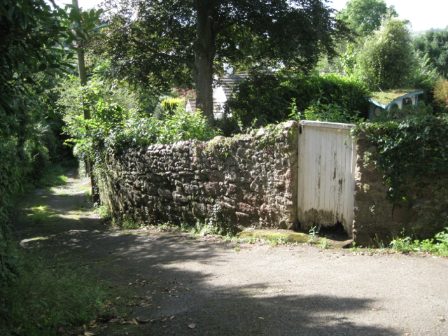
East end of Brookvale Orchard, Ringmore
Brookvale Orchard is part lane, part footpath between Brook Lane and Higher Ringmore Road. The moss-covered blue-and-white object on the right is a small cabin cruiser.
 Map © Crown Copyright")
TIP: Click the map for more Large scale mapping
- Grid Square
- SX9271, 77 images (more nearby 🔍)
- Photographer
- Robin Stott (more nearby)
- Date Taken
- Monday, 20 August, 2012 (more nearby)
- Submitted
- Sunday, 19 May, 2013
- Subject Location
-
OSGB36:
 SX 9263 7199 [10m precision]
WGS84: 50:32.2677N 3:30.9896W - Camera Location
-
OSGB36: SX 9264 7199
- View Direction
- West-northwest (about 292 degrees)