TL3808 : Lea Valley Walk and Navigation
taken 11 years ago, near to Hoddesdon, Hertfordshire, England
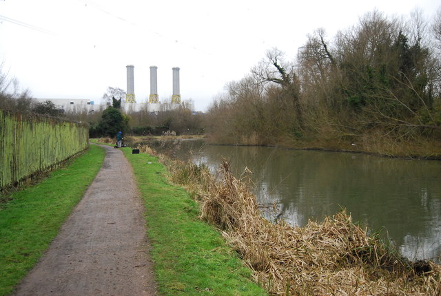
The Lee Navigation is a canalised river incorporating the River Lea (River Lee). It runs from Hertford Castle Weir to the River Thames at Bow Creek; its first lock is Hertford Lock and its last Bow Locks.
See Wikipedia article: Link
National Route 1 of the National Cycle Network is a long distance cycle route connecting Dover and the Shetland Islands mainly via the east coast of England and Scotland. The route is all signed and open except between London and Woodbridge (in Suffolk) and between Whitby and Staithes (in Yorkshire).
The River Lea (or Lee) originates at Marsh Farm Leagrave, Luton in the Chiltern Hills and flows generally southeast, east, and then south to London where it meets the River Thames. The river is 42 miles long.
Wikipedia: Link
A 53 mile long route mainly on riverside paths, linking the source near the Icknield Way Path east of the Dunstable Downs to the London Docklands. It first follows the course of the river, which is variously spelt Lee and Lea, and then after a suburban diversion from the river at Welwyn, it takes the canalised navigations from Hertford, using wherever possible green waterside corridors. It passes the numerous reservoirs that line the Lea valley through North London.
It incorporates the Upper Lea Valley Walk (9 miles and on OS mapping), the Cole Green Way west of Hertford, a multi-user trail including the route of a disused railway, and the Lee Navigation towpath.
From the source at Leagrave, suburban walking in Luton soon leads to countryside and a mainly rural stretch to Hertford where the canalised section starts, with in the same valley corridor the New River Path, also canalised, branching off earlier. Further south a series of large man-made embanked reservoirs lie to the east of the Lea, that continues into east London through marshland reserves rich in wildlife and in green spaces, finally passing close by the west side of the Olympic Park site to reach Bow Locks. From here either the Limehouse Cut or cycling routes along the Lea river can be used to reach the Thames. The short Hertford Union Canal (c. 1.5km) links the River Lea Navigations and the Regent's Canal along the southern side of Victoria Park.
Rye House Power Station is a 715MW combined cycle gas turbine (CCGT) power station close to Rye House railway station in Hoddesdon. The gas-fired station, was built in the early 1990s and fully commissioned in November 1993 and officially opened in April 1994. Output from the station is enough to meet the daily power needs of nearly a million people - almost the population of Hertfordshire.
 Map © Crown Copyright")
- Grid Square
- TL3808, 91 images (more nearby 🔍)
- Photographer
- N Chadwick (more nearby)
- Date Taken
- Sunday, 3 February, 2013 (more nearby)
- Submitted
- Tuesday, 28 May, 2013
- Subject Location
-
OSGB36:
 TL 3895 0875 [10m precision]
WGS84: 51:45.6122N 0:0.7149E - Camera Location
-
OSGB36: TL 3898 0872
- View Direction
- Northwest (about 315 degrees)