2013
SP4704 : Cumnor Heights
taken 11 years ago, near to Cumnor, Oxfordshire, England
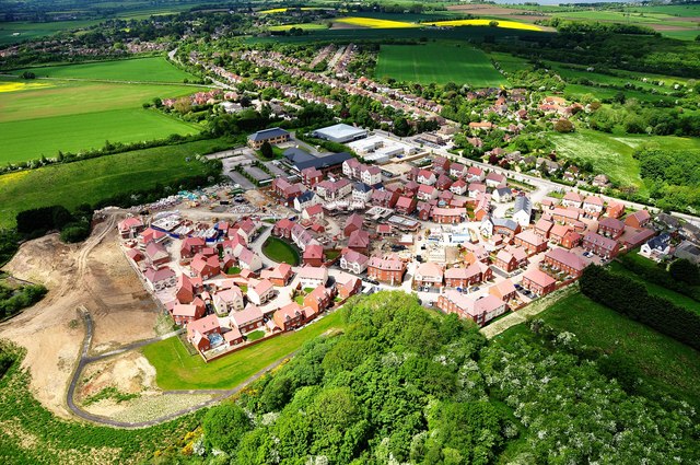
Cumnor Heights
New housing development at the top of Cumnor Hill, on the site of the old timber yard, Timbmets.
 Map © Crown Copyright")
TIP: Click the map for more Large scale mapping
- Grid Square
- SP4704, 32 images (more nearby 🔍)
- Photographer
- Dave Price (more nearby)
- Date Taken
- Sunday, 2 June, 2013 (more nearby)
- Submitted
- Tuesday, 4 June, 2013
- Subject Location
-
OSGB36:
 SP 4733 0442 [10m precision]
WGS84: 51:44.1899N 1:18.9600W - Camera Location
-
OSGB36: SP 4777 0426
- View Direction
- West-northwest (about 292 degrees)