2007
SO2819 : Farmland above Blaenawey
taken 17 years ago, near to Bettws, Monmouthshire/Sir Fynwy, Wales
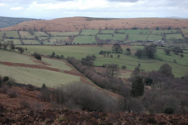
Farmland above Blaenawey
This farmland is on the eastern slopes of the Sugarloaf. Bryn Arw can be seen in the middle distance.
 Map © Crown Copyright")
TIP: Click the map for more Large scale mapping
- Grid Square
- SO2819, 17 images (more nearby 🔍)
- Photographer
- Philip Halling (more nearby)
- Date Taken
- Sunday, 25 February, 2007 (more nearby)
- Submitted
- Wednesday, 28 February, 2007
- Subject Location
-
OSGB36:
 SO 288 196 [100m precision]
WGS84: 51:52.2521N 3:2.0808W - Camera Location
-
OSGB36: SO 284 195
- View Direction
- EAST (about 90 degrees)