2013
SK1173 : Tunstead Quarry
taken 11 years ago, near to Wormhill, Derbyshire, England
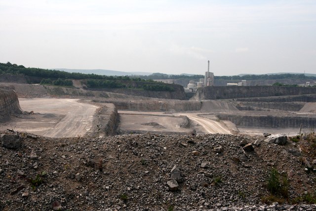
Tunstead Quarry
A small part of this huge limestone quarry and cement works near Buxton. The quarry has expanded since the OS map was last updated. There's a thankfully more typical White Peak landscape just a few yards to the east SK1174 : Flag Dale
 Map © Crown Copyright")
TIP: Click the map for more Large scale mapping
- Grid Square
- SK1173, 13 images (more nearby 🔍)
- Photographer
- Graham Hogg (more nearby)
- Date Taken
- Wednesday, 19 June, 2013 (more nearby)
- Submitted
- Tuesday, 25 June, 2013
- Subject Location
-
OSGB36:
 SK 1122 7393 [10m precision]
WGS84: 53:15.7352N 1:49.9954W - Camera Location
-
OSGB36: SK 1140 7390
- View Direction
- WEST (about 270 degrees)