2013
NT9659 : Pond south of Lamberton Holdings
taken 11 years ago, near to Burnmouth, Scottish Borders, Scotland
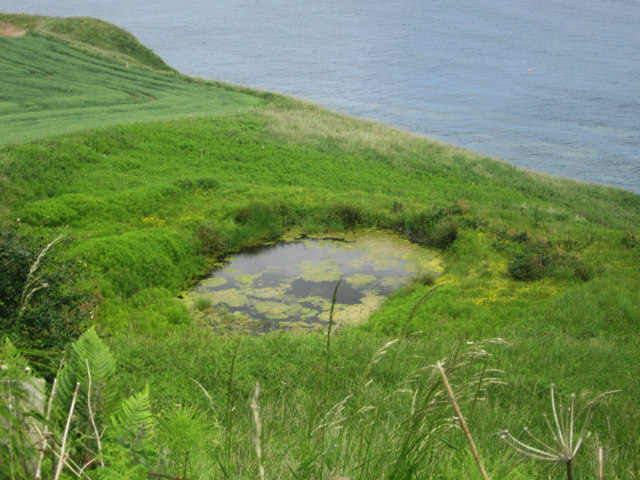
Pond south of Lamberton Holdings
This pond sits in what appears to be a boggy area of land on the cliff tops south of Lamberton Holdings.
 Map © Crown Copyright")
TIP: Click the map for more Large scale mapping
- Grid Square
- NT9659, 139 images (more nearby 🔍)
- Photographer
- Graham Robson (more nearby)
- Date Taken
- Wednesday, 3 July, 2013 (more nearby)
- Submitted
- Friday, 5 July, 2013
- Subject Location
-
OSGB36:
 NT 9650 5980 [10m precision]
WGS84: 55:49.8853N 2:3.4467W - Camera Location
-
OSGB36: NT 9648 5979
- View Direction
- Northeast (about 45 degrees)