2013
TF1860 : The Oat Sheaf, Timberland Dales
taken 11 years ago, near to Martin Dales, Lincolnshire, England
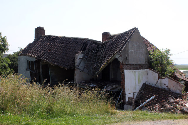
The Oat Sheaf, Timberland Dales
I can find little history of this pub on the banks of the Witham. The 1889 to 1956 maps show it as The Oat Sheaf Inn. The next map in 1972 shows it as The Old Oatsheaf. On 5th August 1824 Cuthbert and Son Auctioned the 'OAT Sheaf....in the occupation of William THORPE' with 'Twenty Acres of Arable and Pasture Land' for the owner J Parkinson Esq. of Bolingbroke. W E Tonge tells us in the 'Chronicles of the Tonge Family' that 'Mrs Mabbot owned the Oat Sheaf and when she had paid the mortgage on it she had about 10 shillings a week to live on'. Recorded publicans are William Thorpe 1824, Dennis Abbot 1856, Mrs Jane Abbott 1861 and George Cook/e 1868 & 1872. From the 1885 Kelly's on the only public house listed in Timberland is the 'Houghton Arms' (probably previously Milnes Arms).
 Map © Crown Copyright")
TIP: Click the map for more Large scale mapping
- Grid Square
- TF1860, 46 images (more nearby 🔍)
- Photographer
- Jo and Steve Turner (more nearby)
- Date Taken
- Sunday, 7 July, 2013 (more nearby)
- Submitted
- Saturday, 13 July, 2013
- Subject Location
-
OSGB36:
 TF 1864 6023 [10m precision]
WGS84: 53:7.5627N 0:13.7055W - Camera Location
-
OSGB36: TF 1864 6025
- View Direction
- SOUTH (about 180 degrees)