2013
SP4093 : Ashby Canal: Site of Bridge Number 18
taken 11 years ago, near to Hinckley, Leicestershire, England
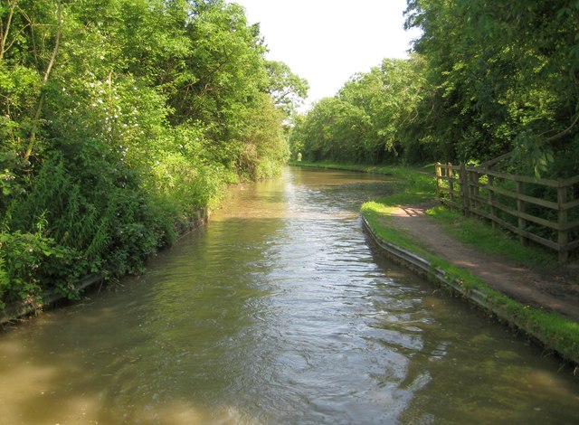
Ashby Canal: Site of Bridge Number 18
This narrowing of the canal is where Bridge Number 18 used to carry a byway from Watling Street to Wykin over it. The bridge was unfortunately demolished just before the canal became a statutory conservation area. Confusingly various editions and scales of the Ordnance Survey mapping, including the version of the 1:50,000 scale mapping currently available to the Geograph site, still show the bridge as extant with rights of way leading up to the non-existent crossing. A short diversion of a couple of a hundred metres northwards to Bridge Number 19 is necessary (unless you are carrying a boat or want to swim across...).
 Map © Crown Copyright")
TIP: Click the map for more Large scale mapping
- Grid Square
- SP4093, 78 images (more nearby 🔍)
- Photographer
- Nigel Cox (more nearby)
- Date Taken
- Monday, 8 July, 2013 (more nearby)
- Submitted
- Sunday, 21 July, 2013
- Subject Location
-
OSGB36:
 SP 4007 9399 [10m precision]
WGS84: 52:32.5379N 1:24.6359W - Camera Location
-
OSGB36: SP 4005 9399
- View Direction
- EAST (about 90 degrees)