2013
SU6101 : Portsmouth Harbour, Hardway
taken 11 years ago, near to Hardway, Hampshire, England
This is 1 of 3 images, with title Portsmouth Harbour, Hardway in this square
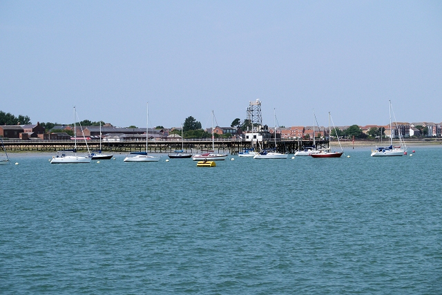
Portsmouth Harbour, Hardway
Portsmouth Harbour is a large natural harbour. Geographically it is a coastal inlet formed by the partial submergence of an unglaciated river valley that remains open to the sea. It is the drowned valley of a stream flowing from Portsdown into the Solent River. The city of Portsmouth lies to the east on Portsea Island, and Gosport to the west on the mainland. At its north end is Portchester Castle, of Roman origin and the first fortress built to protect the harbour.
The mouth of the harbour provides access to the Solent. It is best known as the home of the Royal Navy, HMNB Portsmouth. Because of its strategic location on the south coast of England, protected by the natural defence of the Isle of Wight, it has since the Middle Ages been the home to England's (and later Britain's) navy. The narrow entrance, and the forts surrounding it gave it a considerable advantage of being virtually impregnable to attack from the sea.
In modern times, the harbour has become a major commercial ferry port, with regular services to Le Havre, France, Cherbourg, France, St Malo, France, The Channel Islands and the Isle of Wight. There is a passenger ferry to Gosport. It is also a major area for leisure sailing. Recently, a large area of the former naval dockyard has been redeveloped into the Gunwharf Quays development, including the Spinnaker Tower.
Link Wikipedia
See other images of Portsmouth Harbour
The mouth of the harbour provides access to the Solent. It is best known as the home of the Royal Navy, HMNB Portsmouth. Because of its strategic location on the south coast of England, protected by the natural defence of the Isle of Wight, it has since the Middle Ages been the home to England's (and later Britain's) navy. The narrow entrance, and the forts surrounding it gave it a considerable advantage of being virtually impregnable to attack from the sea.
In modern times, the harbour has become a major commercial ferry port, with regular services to Le Havre, France, Cherbourg, France, St Malo, France, The Channel Islands and the Isle of Wight. There is a passenger ferry to Gosport. It is also a major area for leisure sailing. Recently, a large area of the former naval dockyard has been redeveloped into the Gunwharf Quays development, including the Spinnaker Tower.
Link
See other images of Portsmouth Harbour
 Map © Crown Copyright")
TIP: Click the map for more Large scale mapping
- Grid Square
- SU6101, 410 images (more nearby 🔍)
- Photographer
- David Dixon (more nearby)
- Date Taken
- Thursday, 18 July, 2013 (more nearby)
- Submitted
- Thursday, 25 July, 2013
- Subject Location
-
OSGB36:
 SU 613 018 [100m precision]
WGS84: 50:48.7667N 1:7.8175W - Camera Location
-
OSGB36: SU 616 019
- View Direction
- West-southwest (about 247 degrees)