2013
SK1794 : Upper Derwent valley at the head of Howden Reservoir
taken 11 years ago, near to Cold Side [other Features], Sheffield, Great Britain
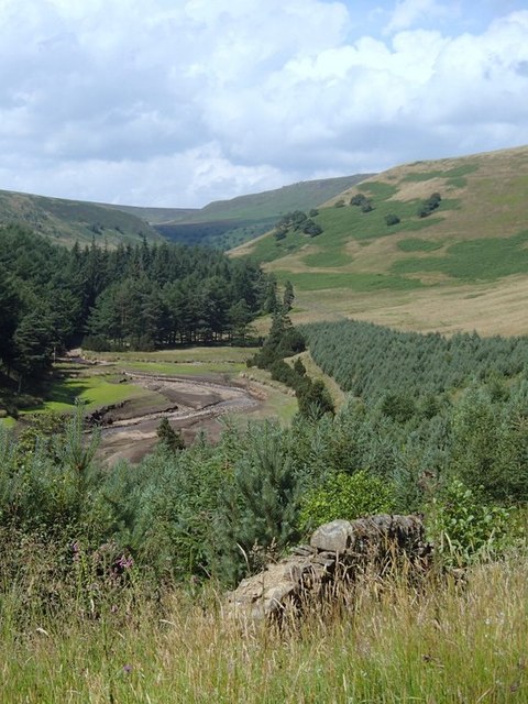
Upper Derwent valley at the head of Howden Reservoir
The low water levels mean the head of the reservoir is almost dry in this summer view.
 Map © Crown Copyright")
TIP: Click the map for more Large scale mapping
- Grid Square
- SK1794, 33 images (more nearby 🔍)
- Photographer
- Andrew Hill (more nearby)
- Date Taken
- Thursday, 25 July, 2013 (more nearby)
- Submitted
- Friday, 26 July, 2013
- Subject Location
-
OSGB36:
 SK 1714 9440 [10m precision]
WGS84: 53:26.7655N 1:44.6044W - Camera Location
-
OSGB36: SK 1718 9418
- View Direction
- North-northwest (about 337 degrees)