2013
SJ8497 : Manchester: River Medlock from Charles Street
taken 11 years ago, near to Manchester, England
This is 1 of 72 images, with title starting with Manchester in this square
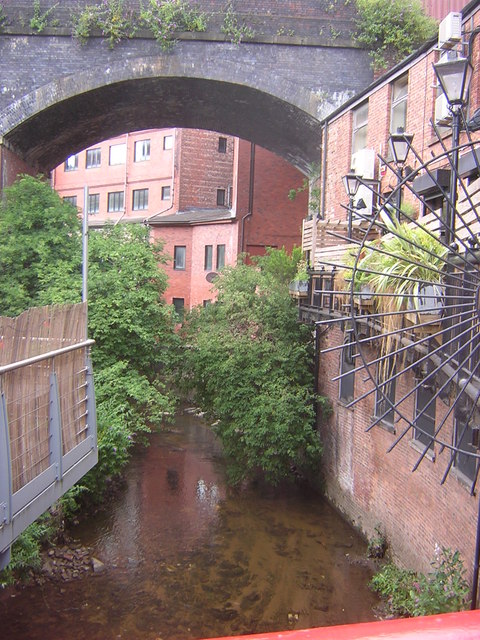
Manchester: River Medlock from Charles Street
The River Medlock flows west from Tameside & Oldham into Manchester. It runs for 13 miles (including passing through Clayton Vale) before merging with the Irwell at Castlefield. The Industrial revolution exacted a heavy toll on the river, factories & waste tips lining its banks decreased the water quality to such an extent that the river stopped being able to support a fish population. Recent restoration has, however, improved water quality, the river was restocked with fish, and wildlife such as herons and kingfishers can often be seen now.
See other images of River Medlock
See other images of River Medlock
 Map © Crown Copyright")
TIP: Click the map for more Large scale mapping
- Grid Square
- SJ8497, 2109 images (more nearby 🔍)
- Photographer
- Christopher Hilton (more nearby)
- Date Taken
- Thursday, 25 July, 2013 (more nearby)
- Submitted
- Saturday, 27 July, 2013
- Subject Location
-
OSGB36:
 SJ 8431 9753 [10m precision]
WGS84: 53:28.4558N 2:14.2712W - Camera Location
-
OSGB36: SJ 8432 9751
- View Direction
- North-northwest (about 337 degrees)