2013
NM7417 : Flooded Slate Quarry at Ellenabeich
taken 11 years ago, near to Ellenabeich, Seil, Argyll And Bute, Scotland
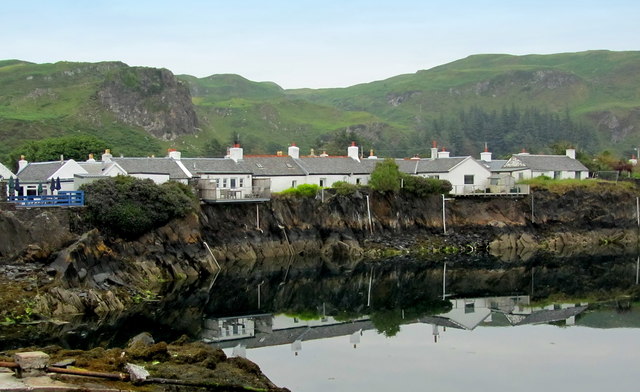
Flooded Slate Quarry at Ellenabeich
Dwellings perched precariously on the edge of the quarry side - flooded naturally by the sea.
 Map © Crown Copyright")
TIP: Click the map for more Large scale mapping
- Grid Square
- NM7417, 258 images (more nearby 🔍)
- Photographer
- Chris Heaton (more nearby)
- Date Taken
- Tuesday, 16 July, 2013 (more nearby)
- Submitted
- Sunday, 28 July, 2013
- Subject Location
-
OSGB36:
 NM 7428 1730 [10m precision]
WGS84: 56:17.6556N 5:38.9619W - Camera Location
-
OSGB36: NM 7419 1727
- View Direction
- East-northeast (about 67 degrees)