2013
TL3812 : Stanstead Lock, River Lee Navigation
taken 11 years ago, near to St Margarets, Hertfordshire, England
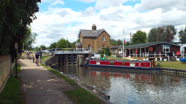
Stanstead Lock, River Lee Navigation
The towpath alongside the River Lee Navigation is shared by walkers and cyclists. It forms part of the National Cycle Network.
Lea Navigation (Lee Navigation)
The Lee Navigation is a canalised river incorporating the River Lea (River Lee). It runs from Hertford Castle Weir to the River Thames at Bow Creek; its first lock is Hertford Lock and its last Bow Locks.
See Wikipedia article: Link
 Map © Crown Copyright")
TIP: Click the map for more Large scale mapping
- Grid Square
- TL3812, 31 images (more nearby 🔍)
- Photographer
- Malc McDonald (more nearby)
- Date Taken
- Saturday, 3 August, 2013 (more nearby)
- Submitted
- Sunday, 4 August, 2013
- Subject Location
-
OSGB36:
 TL 3804 1213 [10m precision]
WGS84: 51:47.4480N 0:0.0048E - Camera Location
-
OSGB36: TL 3804 1212
- View Direction
- NORTH (about 0 degrees)