2013
SP5306 : Headington Hill, Oxford
taken 11 years ago, near to Oxford, Oxfordshire, England
This is 1 of 2 images, with title Headington Hill, Oxford in this square
Headington Hill, Oxford
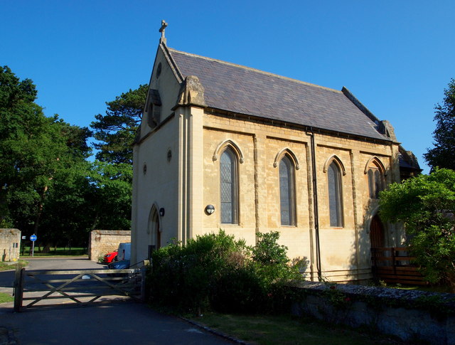
A north facing shot of Warneford Psychiatric Hospital's chapel taken from an internal service road. It is situated parallel with Warneford Lane ahead, although this has now become a busy dual carriageway. This Grade II-listed former 'asylum chapel' was constructed between 1841-51 and was built at the rear of the hospital site. The grander buildings, forming the front of the hospital, are to the east of the site. The chapel's west end elevation has evidently been re-faced.
 Map © Crown Copyright")
TIP: Click the map for more Large scale mapping
- Grid Square
- SP5306, 110 images (more nearby 🔍)
- Photographer
- David Hallam-Jones (more nearby)
- Date Taken
- Thursday, 1 August, 2013 (more nearby)
- Submitted
- Monday, 5 August, 2013
- Subject Location
-
OSGB36:
 SP 5370 0608 [10m precision]
WGS84: 51:45.0509N 1:13.4104W - Camera Location
-
OSGB36: SP 5371 0607
- View Direction
- Northwest (about 315 degrees)