2012
TF1605 : Railway crossing on Foxcovert Road near Werrington
taken 11 years ago, near to Glinton, Peterborough, England
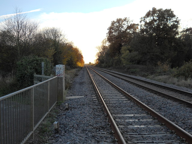
Railway crossing on Foxcovert Road near Werrington
The level crossing on Foxcovert Road is accessible to pedestrians and cyclists but has been closed to motor traffic for many years. The road crosses the line between Peterborough and Lincoln via Spalding and Sleaford. In response to a long-running campaign by local residents following a fatal accident at the crossing in 2009, Network Rail announced in April 2013 that a footbridge would be erected at the site. Construction work is scheduled for completion in March 2014. Foxcovert Road links Werrington on the northern periphery of Peterborough with the villages of Glinton and Peakirk.
UPDATE: For images of Foxcovert Road Crossing following the construction of the footbridge, which was opened to the public in September 2014, see TF1605 : New footbridge at Foxcovert Road crossing, Glinton and TF1605 : New footbridge at Foxcovert Road crossing, Glinton
UPDATE: For images of Foxcovert Road Crossing following the construction of the footbridge, which was opened to the public in September 2014, see TF1605 : New footbridge at Foxcovert Road crossing, Glinton and TF1605 : New footbridge at Foxcovert Road crossing, Glinton
 Map © Crown Copyright")
TIP: Click the map for more Large scale mapping
- Grid Square
- TF1605, 60 images (more nearby 🔍)
- Photographer
- Paul Bryan (more nearby)
- Date Taken
- Sunday, 18 November, 2012 (more nearby)
- Submitted
- Friday, 9 August, 2013
- Subject Location
-
OSGB36:
 TF 1629 0503 [10m precision]
WGS84: 52:37.8346N 0:16.9938W - Camera Location
-
OSGB36: TF 1636 0515
- View Direction
- South-southwest (about 202 degrees)