2013
SK2281 : Coggers Lane, Hathersage
taken 11 years ago, near to Hathersage, Derbyshire, England
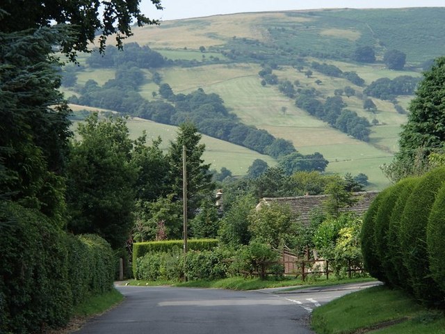
Coggers Lane, Hathersage
This section of the village is set on quite a steep hillside with views across the valley.
 Map © Crown Copyright")
TIP: Click the map for more Large scale mapping
- Grid Square
- SK2281, 78 images (more nearby 🔍)
- Photographer
- Andrew Hill (more nearby)
- Date Taken
- Thursday, 8 August, 2013 (more nearby)
- Submitted
- Friday, 9 August, 2013
- Subject Location
-
OSGB36:
 SK 2261 8164 [10m precision]
WGS84: 53:19.8717N 1:39.7176W - Camera Location
-
OSGB36: SK 2264 8166
- View Direction
- West-southwest (about 247 degrees)