2013
J4569 : Demolished shops, Comber (2)
taken 11 years ago, near to Comber, Co Down, Northern Ireland
Demolished shops, Comber (2)
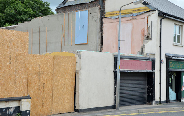
See J4569 : Demolished shops, Comber. A small piece of one of the shops has been left intact as part of the boundary. Continue to J4569 : Demolished shops, Comber (3) (October 2013).
Nos 19-21 Castle Street, Comber
A site, at the corner of Castle Street and the Bridge Street Link, for which there is the following planning permission: X/2012/0502/F 19-21 Castle Street, Comber Demolition of existing building and proposed residentail [sic] development for 7no townhouses and 9 no apartments with associated car parking and landscaping (amended plans and ownership certificate).
The photographs submitted by me appear as a matter of record only. I have no connection with any of the parties involved in the development.
Loading map... (JavaScript required)
- Grid Square
- J4569, 201 images (more nearby 🔍)
- Photographer
- Albert Bridge (more nearby)
- Date Taken
- Saturday, 10 August, 2013 (more nearby)
- Submitted
- Sunday, 11 August, 2013
- Subject Location
-
Irish:
 J 458 693 [100m precision]
WGS84: 54:33.0765N 5:44.8057W - Camera Location
-
Irish: J 458 693
- View Direction
- North-northwest (about 337 degrees)