2013
SX4765 : Tidal ford and causeway at Lopwell
taken 11 years ago, near to Milton Combe, Devon, England
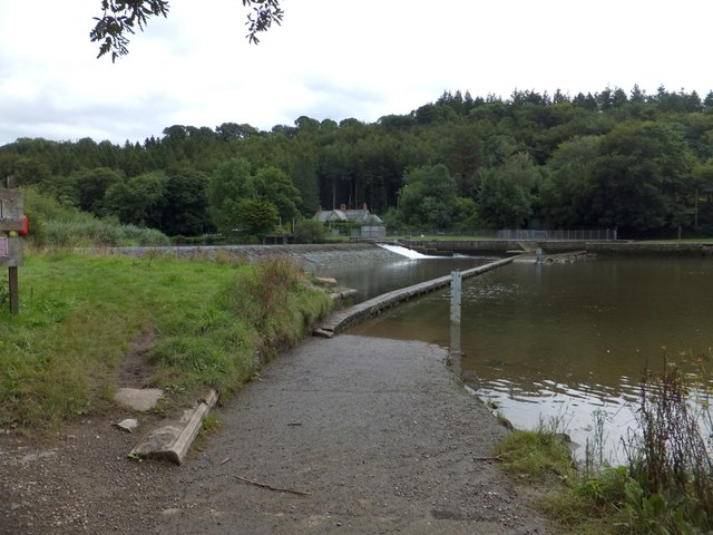
Tidal ford and causeway at Lopwell
The access to the ford through Whittacliffe Wood is not suited to road vehicles. This is the tidal limit on the Tavy; below is saltwater marsh, above the dam is freshwater marsh. The Tamar Valley Discovery Trail crosses the causeway
 Map © Crown Copyright")
TIP: Click the map for more Large scale mapping
- Grid Square
- SX4765, 27 images (more nearby 🔍)
- Photographer
- David Smith (more nearby)
- Date Taken
- Tuesday, 13 August, 2013 (more nearby)
- Submitted
- Thursday, 15 August, 2013
- Subject Location
-
OSGB36:
 SX 4739 6504 [10m precision]
WGS84: 50:27.9166N 4:9.0985W - Camera Location
-
OSGB36: SX 4735 6506
- View Direction
- East-southeast (about 112 degrees)