2012
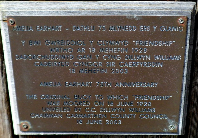
SN4400 : Plaque on a historic wooden buoy, Burry Port
taken 12 years ago, near to Burry Port, Carmarthenshire/Sir Gaerfyrddin, Wales
 Map © Crown Copyright")
TIP: Click the map for more Large scale mapping
- Grid Square
- SN4400, 292 images (more nearby 🔍)
- Photographer
- Jaggery (more nearby)
- Date Taken
- Sunday, 15 April, 2012 (more nearby)
- Submitted
- Friday, 16 August, 2013
- Subject Location
-
OSGB36:
 SN 4463 0026 [10m precision]
WGS84: 51:40.7732N 4:14.9194W - Camera Location
-
OSGB36: SN 4463 0026
- View Direction
- WEST (about 270 degrees)