2013
SP5107 : Radcliffe Infirmary & County Hospital - Woodstock Road
taken 11 years ago, near to Oxford, Oxfordshire, England
This is 1 of 3 images, with title starting with Radcliffe Infirmary in this square
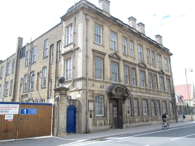
Radcliffe Infirmary & County Hospital - Woodstock Road
Built 1912
 Map © Crown Copyright")
TIP: Click the map for more Large scale mapping
- Grid Square
- SP5107, 360 images (more nearby 🔍)
- Photographer
- Betty Longbottom (more nearby)
- Date Taken
- Monday, 12 August, 2013 (more nearby)
- Submitted
- Saturday, 17 August, 2013
- Subject Location
-
OSGB36:
 SP 5105 0707 [10m precision]
WGS84: 51:45.5998N 1:15.7048W - Camera Location
-
OSGB36: SP 5106 0708
- View Direction
- West-southwest (about 247 degrees)