2006
NX9890 : Last bend on the 'Ae Line' red route
taken 18 years ago, near to Ae, Dumfries And Galloway, Scotland
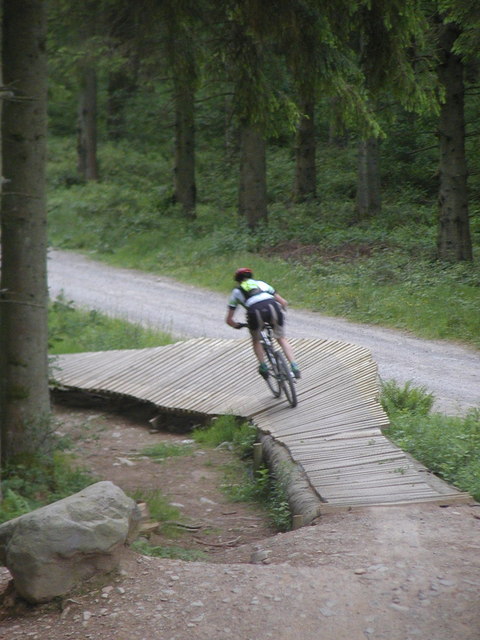
Last bend on the 'Ae Line' red route
The development of mountain bike tracks in southern Scotland has marked a major change in the way the Forestry Commission see its estate and what it is for; the 7stanes tracks, including Ae, are the highlights of this effort and are regarded as some of the finest man-made mountain bike facilities in the world. Here a rider negotiates the last bend on the red-graded Ae Line, a planked berm.
 Map © Crown Copyright")
TIP: Click the map for more Large scale mapping
- Grid Square
- NX9890, 13 images (more nearby 🔍)
- Photographer
- Simon Brooke (more nearby)
- Date Taken
- Saturday, 17 June, 2006 (more nearby)
- Submitted
- Saturday, 10 March, 2007
- Subject Location
-
OSGB36:
 NX 984 902 [100m precision]
WGS84: 55:11.7785N 3:35.8495W - Camera Location
-
OSGB36: NX 984 903
- View Direction
- South-southwest (about 202 degrees)