2013
SJ3915 : Severn viewpoint 2 - Shrawardine, Shropshire
taken 11 years ago, near to Shrawardine, Shropshire, England
Severn viewpoint 2 - Shrawardine, Shropshire
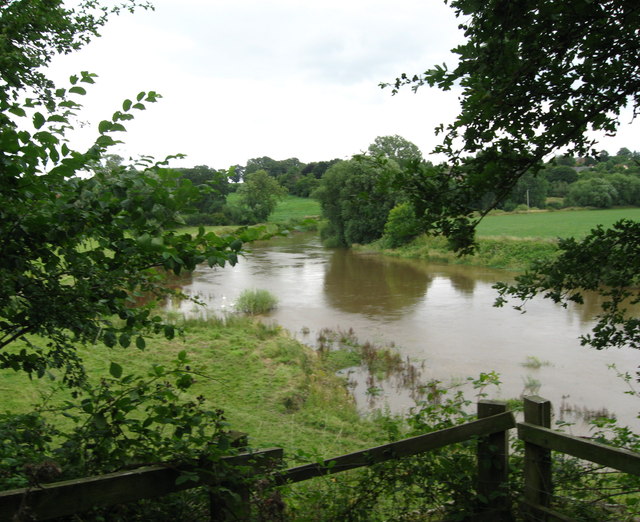
A public footpath from Shrawardine - 'Shraden' to the locals - ends here at the site of a one time railway bridge over the Severn. The bridge, which was demolished in 1962, was on the route of the Shropshire & Montgomeryshire Railway, which had a chequered history in at times private and military ownership. Taken at 11.26 am BST (British Summer Time).
SJ3915 : Severn viewpoint 1 - Shrawardine, Shropshire SJ3915 : Severn viewpoint 3 - Shrawardine, Shropshire SJ3915 : Severn viewpoint 4 - Shrawardine, Shropshire
SJ3915 : Severn viewpoint 1 - Shrawardine, Shropshire SJ3915 : Severn viewpoint 3 - Shrawardine, Shropshire SJ3915 : Severn viewpoint 4 - Shrawardine, Shropshire
 Map © Crown Copyright")
TIP: Click the map for more Large scale mapping
- Grid Square
- SJ3915, 19 images (more nearby 🔍)
- Photographer
- Martin Richard Phelan (more nearby)
- Date Taken
- Saturday, 17 August, 2013 (more nearby)
- Submitted
- Sunday, 18 August, 2013
- Subject Location
-
OSGB36:
 SJ 3939 1543 [10m precision]
WGS84: 52:43.9856N 2:53.9421W - Camera Location
-
OSGB36: SJ 3928 1541
- View Direction
- EAST (about 90 degrees)