2011
SP3519 : The road to Charlbury - Charlbury, Oxfordshire
taken 13 years ago, near to Charlbury, Oxfordshire, England
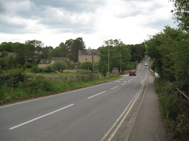
The road to Charlbury - Charlbury, Oxfordshire
The name Charlbury - Ceorl's bury (?) is said to date from Anglo Saxon times. This village beside the River Evenlode once hosted many trades and was a centre of the glove-making industry from the 1800s to the 1960s. There was once an annual fair, held on a number of sites in the village, but this was stopped in 1857 when the proceedings became too rowdy. Sadly the YHA vanished from the place some years ago. In the churchyard is the grave of a man who was killed during the making of the railway 'by a fall of earth in Sydenhams Mead'. This approach from the south crosses the Evenlode and beyond on the right is Toll Cottage, possibly a former toll house. Time photo taken 1.27 pm BST (British Summer Time).
 Map © Crown Copyright")
TIP: Click the map for more Large scale mapping
- Grid Square
- SP3519, 198 images (more nearby 🔍)
- Photographer
- Martin Richard Phelan (more nearby)
- Date Taken
- Saturday, 11 June, 2011 (more nearby)
- Submitted
- Monday, 2 September, 2013
- Subject Location
-
OSGB36:
 SP 3542 1956 [10m precision]
WGS84: 51:52.4096N 1:29.2153W - Camera Location
-
OSGB36: SP 3534 1954
- View Direction
- East-northeast (about 67 degrees)