2013
TR0916 : The approach road to Dungeness
taken 11 years ago, 3 km from Lydd-on-Sea, Kent, England
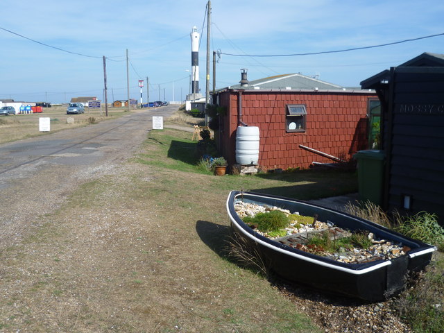
The approach road to Dungeness
There is nowhere else like Dungeness. It is unique with its shingle and plants, ramshackle cottages (many originally old railway carriages), two lighthouses and of course the Romney, Hythe & Dymchurch Railway. This view looks along the approach road towards the new lighthouse. This is the most recent of five and dates from 1961. The Britannia In is just out of the picture on the left. A close up of the boat garden can be seen at Link
 Map © Crown Copyright")
TIP: Click the map for more Large scale mapping
- Grid Square
- TR0916, 250 images (more nearby 🔍)
- Photographer
- Marathon (more nearby)
- Date Taken
- Monday, 2 September, 2013 (more nearby)
- Submitted
- Friday, 6 September, 2013
- Subject Location
-
OSGB36:
 TR 0914 1687 [10m precision]
WGS84: 50:54.8034N 0:58.4263E - Camera Location
-
OSGB36: TR 0908 1686
- View Direction
- EAST (about 90 degrees)