2013
NZ2563 : Bridge Street, the Swing Bridge
taken 11 years ago, near to Gateshead, England
This is 1 of 2 images, with title starting with Bridge Street in this square
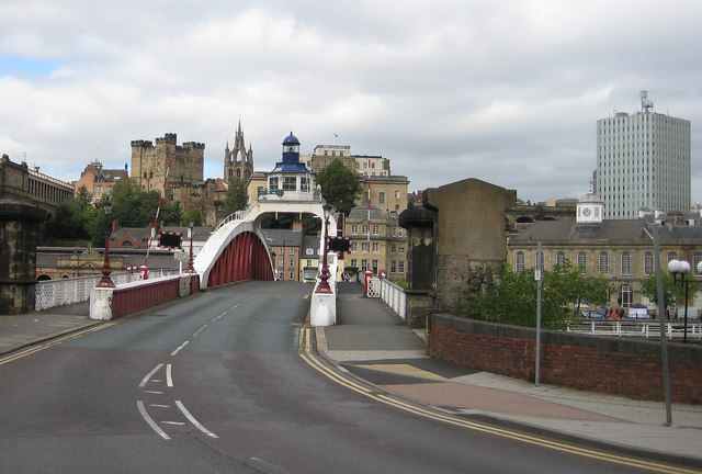
Bridge Street, the Swing Bridge
Connects Gateshead to Newcastle and lies between the Tyne Bridge and the High Level Bridge. In the background is part of the medieval fortification which gave the city of Newcastle its name.
 Map © Crown Copyright")
TIP: Click the map for more Large scale mapping
- Grid Square
- NZ2563, 2029 images (more nearby 🔍)
- Photographer
- Pauline E (more nearby)
- Date Taken
- Sunday, 22 September, 2013 (more nearby)
- Submitted
- Thursday, 26 September, 2013
- Subject Location
-
OSGB36:
 NZ 2523 6368 [10m precision]
WGS84: 54:58.0267N 1:36.4471W - Camera Location
-
OSGB36: NZ 2528 6363
- View Direction
- Northwest (about 315 degrees)