2013
SO9538 : Strata at edge of disused limestone quarry, Bredon Hill
taken 11 years ago, near to Overbury, Worcestershire, England
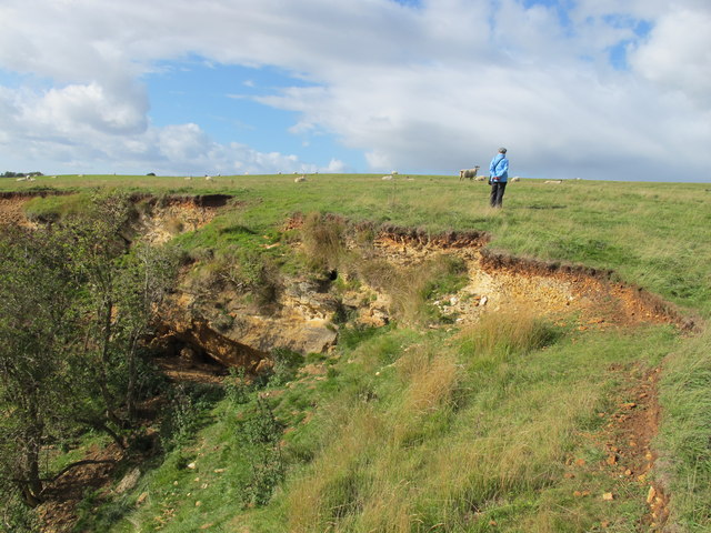
Strata at edge of disused limestone quarry, Bredon Hill
This shows the thin soil, layer of gravel, and solid oolitic Cotswold limestone of the area. This field is pasture for sheep, nearby fields have crops, and there used to be apple orchards.
 Map © Crown Copyright")
TIP: Click the map for more Large scale mapping
- Grid Square
- SO9538, 30 images (more nearby 🔍)
- Photographer
- David Hawgood (more nearby)
- Date Taken
- Monday, 16 September, 2013 (more nearby)
- Submitted
- Thursday, 26 September, 2013
- Subject Location
-
OSGB36:
 SO 9566 3869 [10m precision]
WGS84: 52:2.7951N 2:3.8817W - Camera Location
-
OSGB36: SO 9569 3867
- View Direction
- West-northwest (about 292 degrees)