2013
SP5407 : St Andrew's Church's tower
taken 11 years ago, near to Headington, Oxfordshire, England
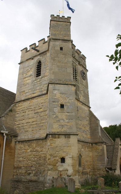
St Andrew's Church's tower
There is an OS benchmark SP5407 : Benchmark on St Andrew's Church at the base of the buttress on the left hand side of the front face. The flagstaff on top of the tower is an OS intersected station trig point, Link
 Map © Crown Copyright")
TIP: Click the map for more Large scale mapping
- Grid Square
- SP5407, 236 images (more nearby 🔍)
- Photographer
- Roger Templeman (more nearby)
- Date Taken
- Wednesday, 18 September, 2013 (more nearby)
- Submitted
- Tuesday, 1 October, 2013
- Subject Location
-
OSGB36:
 SP 5445 0762 [10m precision]
WGS84: 51:45.8773N 1:12.7442W - Camera Location
-
OSGB36: SP 5445 0761
- View Direction
- North-northeast (about 22 degrees)