SH4490 : Parys Mountain Windmill
taken 11 years ago, near to Gadfa, Isle of Anglesey/Sir Ynys Mon, Wales
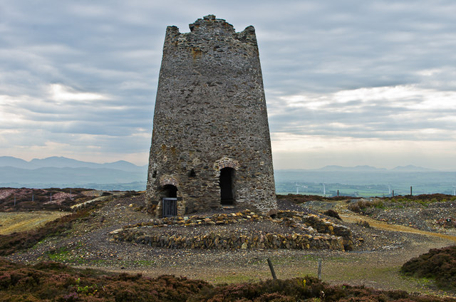
To give a modern twist, beyond can be seen the top of wind turbines on the Trysglwyn wind farm. In the far distance are the mountains of Snowdonia.
The copper deposits on Parys Mountain were known in Bronze Age and Roman times, but it was not until the mid 18th century that the first major ore deposit was discovered, leading to the development of the Parys mine and the smaller Mona mine to the east. After initial disputes between the two concerns, both mines came under the control of local lawyer Thomas Williams. By 1780, the copper from these two mines dominated the world market for the metal, with several thousand people being employed and nearby Amwlch being at the time the second largest town in Wales.
The mines were initially worked from shallow shafts, then opencast and later underground shafts up to 300m deep.
Competition from elsewhere in the world grew during the 19th century and eventually deep mining ceased in the 1880s.
What now remains is a large area of multi-coloured rock and scree which can be explored by following a heritage trail set up by the Amwlch Industrial Heritage Trust. The high acidity of the rock means that there is little plant life, adding to the moonscape appearance.
All is not over though for mining, in that in 1984 Anglesey Mining plc was formed with the aim of restarting ore extraction. Over 2000 tonnes of ore was taken from a new shaft but market conditions meant that development was halted. Further investigation took place in the 1990s and 2000s identifying the significant potential that the site still has.
 Map © Crown Copyright")
- Grid Square
- SH4490, 157 images (more nearby 🔍)
- Photographer
- Ian Capper (more nearby)
- Date Taken
- Saturday, 28 September, 2013 (more nearby)
- Submitted
- Sunday, 6 October, 2013
- Subject Location
-
OSGB36:
 SH 443 905 [100m precision]
WGS84: 53:23.3059N 4:20.5480W - Camera Location
-
OSGB36: SH 443 905
- View Direction
- South-southeast (about 157 degrees)