2013
J0148 : Wind turbine, Mulavilly, Laurelvale (2)
taken 11 years ago, near to Laurelvale, Co Armagh, Northern Ireland
Wind turbine, Mulavilly, Laurelvale (2)
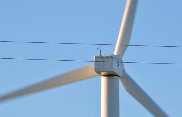
See J0148 : Wind turbine, Mulavilly, Laurelvale (1). A close look, from the Tandragee Road, at the blades. The workings of a turbine and the reason for the anemometer are described in J5079 : Wind turbine, Bangor (1). The blades were turning with a gentle swoosh. This photograph appears as a matter of neutral geographical and historical record only and has no connection with the owner or any objector(s).
Wind turbines, Northern Ireland
A collection of photographs showing a few of the many wind turbines (of all sizes) in Northern Ireland.
All photographs submitted by me appear as a neutral matter of record only. I have no involvement with promoting or objecting to wind power. I have no professional or technical knowledge.
Loading map... (JavaScript required)
- Grid Square
- J0148, 10 images (more nearby 🔍)
- Photographer
- Albert Bridge (more nearby)
- Date Taken
- Thursday, 17 October, 2013 (more nearby)
- Submitted
- Thursday, 17 October, 2013
- Subject Location
-
Irish:
 J 012 485 [100m precision]
WGS84: 54:22.5055N 6:26.5426W - Camera Location
-
Irish: J 014 486
- View Direction
- Southwest (about 225 degrees)