2013
SD8401 : Metrolink, Woodlands Road
taken 11 years ago, near to Cheetham Hill, Manchester, England
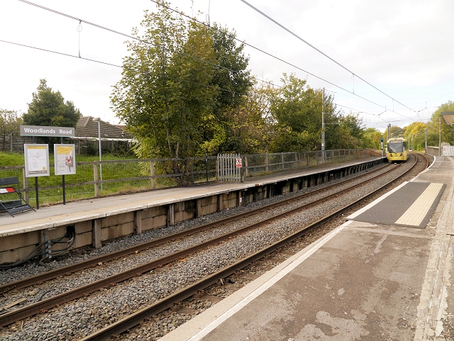
Metrolink, Woodlands Road
Woodlands Road Metrolink station was originally opened in 1913 as a heavy rail station on the former Manchester Victoria to Bury railway line which was converted to the Metrolink tramway in 1992.
The station serves the Cheetham Hill area of North Manchester and is currently the closest Metrolink station to Manchester. However, since the opening of the nearby stop next to the Abraham Moss Centre, in 2011, trams only stop at Woodlands Road between 10am and 4pm on weekdays. Once the new stop at Queens Road (SD8500 : Queens Road Tram Stop Under Construction) is completed, the Woodlands Road station will close completely.
The station serves the Cheetham Hill area of North Manchester and is currently the closest Metrolink station to Manchester. However, since the opening of the nearby stop next to the Abraham Moss Centre, in 2011, trams only stop at Woodlands Road between 10am and 4pm on weekdays. Once the new stop at Queens Road (SD8500 : Queens Road Tram Stop Under Construction) is completed, the Woodlands Road station will close completely.
 Map © Crown Copyright")
TIP: Click the map for more Large scale mapping
- Grid Square
- SD8401, 103 images (more nearby 🔍)
- Photographer
- David Dixon (more nearby)
- Date Taken
- Thursday, 17 October, 2013 (more nearby)
- Submitted
- Thursday, 17 October, 2013
- Subject Location
-
OSGB36:
 SD 8464 0135 [10m precision]
WGS84: 53:30.5165N 2:13.9842W - Camera Location
-
OSGB36: SD 8467 0129
- View Direction
- North-northwest (about 337 degrees)