2013
NT2273 : Water of Leith path
taken 11 years ago, 3 km from Corstorphine, Edinburgh, Scotland
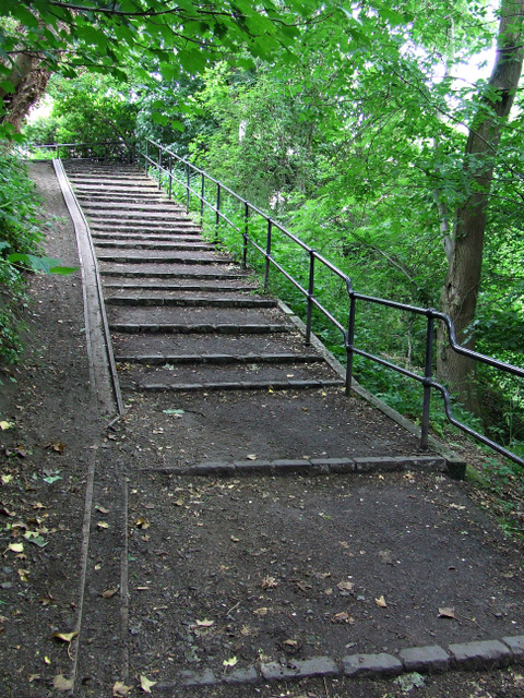
Water of Leith path
Leading up the steep hill from the river to Roseburn Cliff.
 Map © Crown Copyright")
TIP: Click the map for more Large scale mapping
- Grid Square
- NT2273, 192 images (more nearby 🔍)
- Photographer
- Thomas Nugent (more nearby)
- Date Taken
- Monday, 24 June, 2013 (more nearby)
- Submitted
- Wednesday, 23 October, 2013
- Subject Location
-
OSGB36:
 NT 2298 7325 [10m precision]
WGS84: 55:56.7656N 3:14.0875W - Camera Location
-
OSGB36: NT 2299 7327
- View Direction
- South-southwest (about 202 degrees)